
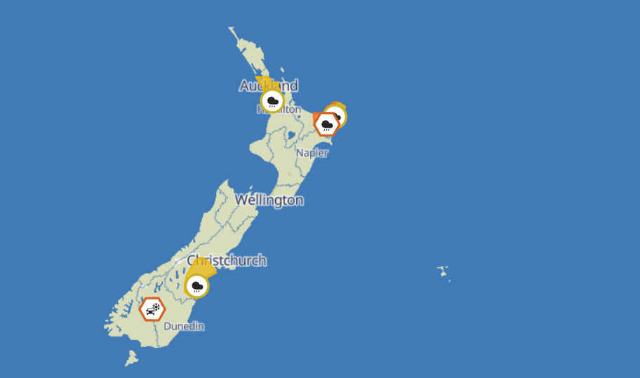
A series of severe weather warnings and watches have been issued as a front followed by multiple active troughs moves across the country, bringing heavy rain and the risk of thunderstorms to several regions on Sunday.
An Orange Heavy Rain Warning is in place for parts of the Bay of Plenty, specifically east of the Whakatāne River, from 6am to 4pm. Forecasters expect between 80 and 110mm of rain during this period, with peak rainfall rates of 15 to 25mm per hour in thunderstorms and a low risk of more intense localised downpours reaching up to 40mm per hour. Authorities warn that streams and rivers could rise rapidly, with surface flooding, slips, and hazardous driving conditions likely.
Meanwhile, Heavy Rain Watches have been issued for multiple regions, including areas of Auckland south and west of Warkworth, Gisborne north of Tokomaru Bay, and parts of South Canterbury south of the Rakaia River, excluding the Mackenzie Basin. These areas could see periods of heavy rain and possible thunderstorms throughout the day, with rainfall totals potentially nearing warning thresholds. Officials say there is a moderate chance these watches could be upgraded to warnings as conditions develop.
Residents in affected areas are being urged to prepare by clearing drains and gutters, avoiding flood-prone locations, and exercising caution on the roads. The warnings were issued at 7:07am today.
For updates and warnings in your area, visit MetService.com.


FFS its the weather
The ministry of soy are hard at work crying wolf again
Exactly Michelle. I’m quite disappointed in DTNZ getting on the fearmongering weather bandwagon.with their ‘could/possibly/potential/chance’ descriptions. I thought I’d clicked on a MSM site by accident.
What rain?